google8d2f7fffcdc71abe.html

Meghalaya

Scotland of the East

“Welcome to the Scotland of the East.” The battered road sign on a hairpin curve on India’s National Highway 40 looked incongruous amid the stands of bamboo and sub-tropical vegetation. For a moment, I wondered if I was hallucinating. The scenery didn’t look any different from that Stephanie and I had seen for the past hour as our shared taxi labored up the twisting highway from the Brahmaputra valley into the Khasi Hills, passing villages that looked much like other villages in northeast India. No medieval castles shrouded in mist. No sweeping views of lochs and glens.  No sheep (only the usual cattle and goats on the road). Not a single sprig of heather. And definitely no kilts. But I wasn’t dreaming. The sign contained the imprimatur of the Meghalaya Tourism Board, so at least someone thought we were in Scotland.

FB cover (2) (600x235).jpg

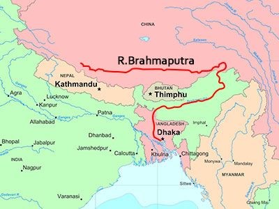
We were on our way to Shillong, the capital of Meghalaya, the small, hilly state sandwiched between western Assam to the north and Bangladesh to the south. The end of the first Anglo-Burmese War in 1826 left the British East India Company in control of Assam and the northeast. The company depended on the river system for transportation, with steamers from Kolkata and other ports carrying troops, supplies, merchants and missionaries up the Brahmaputra. The company’s regional administrator, David Scott, devised a plan to build a road from the plains of Bengal through the hills to the Brahmaputra to provide an alternative route that would not be affected by annual flooding. After a four-year war with the Khasi, the British took control of the hill country south of the Brahmaputra and posted a political agent to the settlement of Cherrapunjee. In 1864, the administration established a hill station at Shillong. A decade later, it became the capital of the province of Assam, and retained its status until 1972 when it became capital of the newly-created state of Meghalaya.

Scotland of East.jpg

The “Scotland” story goes something like this (there is no official version, so I am taking literary license). Reaching the crest of a hill, the East India Company agents, weary from their journey from the sweltering lowlands, looked out through the drizzle on a landscape of grassy, treeless hills, mountain streams and clear lakes. “Reminds me of Ben Lomond,” said one. “Nay, Speyside,” replied another. Either way, it looked like Scotland, or as close to Scotland as homesick, tired and dehydrated East India Company agents could imagine. History—or at least the Meghalaya Tourist Board road sign—would have been different if those first agents had come from the Lake District, Yorkshire, Northumberland or North Wales.

Whatever the origin of the Scotland label, it stuck. At an elevation of almost 5,000 feet, the hill station of Shillong had a mild climate—cool and rainy in summer, cool and dry in winter—offering welcome relief from the searing temperatures of the lowlands. The British planted pine trees, and built Victorian bungalows, churches, a polo ground and a golf course called Gleneagles. For half a century, Shillong resembled a transplanted British country town. Then India crowded in. Today, Shillong with a population of 150,000 is (by Indian standards) a large town; its suburbs, sprawling across the hills, add another 200,000 to the metropolitan area. Khasis make up most of the population, with other northeastern tribes represented, as well as Assamese, Bengalis and migrants from mainland India.

About half the population of Meghalaya, and two thirds of Shillong, listed themselves as Christian on the 2011 census. Protestant and French Catholic missionaries had followed the colonial administrators into the hill country and found willing converts among the tribal peoples, many of whom mixed Christianity with traditional beliefs. Not surprisingly for the “Scotland of the East,” Presbyterians form the largest denomination; they built sturdy stone and timber churches in Shillong and other towns. Immigrants from Assam and mainland India have recently led to a resurgence of Hinduism with about one in four in Shillong listing Hinduism as their religion.

Shillong+church.jpg

The Presbyterians win in the numbers game but it’s the Catholics who win the architectural prize for the Cathedral of Mary Help of Christians, situated on a hill a mile south of the center of Shillong. It is the principal place of worship for the Shillong Archdiocese, which has 33 parishes and an estimated 300,000 adherents. The cathedral stands out not only because of its Art Deco style but because of its color—a striking shade of blue, which also brands the schools, social service centers and shrine around the cathedral—and its foundation. Or rather, lack of foundation. Because the Shillong region is prone to earthquakes, the church was built on trenches filled with sand and has no direct connection with the rock. Theoretically, during an earthquake, the building can shift safely on the shock-absorbing sand.

We visited the cathedral with Ratul Baruah, the news editor of the English-language Meghalaya Guardian, whom I had met on the flight from Delhi to Guwahati. With its high arches and long stained-glass windows, the cathedral has been described as modern Gothic. By Catholic standards, its interior seemed uncluttered, with just a few large paintings and banners.  The banners, explained Ratul, were in the Khasi language, indicating how the missionaries had adapted their religion to local sensibilities.

After the visit, Ratul took us for lunch at a restaurant owned by his friend, Raphael, an artist and local TV station owner. We talked about the vibrant local media scene; in addition to Ratul’s newspaper, three other English-language weeklies and newspapers in indigenous languages—Khasi, Jaintia and Garo—circulate in Meghalaya. I told Raphael I was curious about his name. “Well, I have a Khasi name,” he told me, “but my family is Catholic, so my mother had to give me a Christian name. Don’t you think Raphael is a pretty good name for an artist?”


Son of Brahma

In India’s so-called “chicken neck,” the seven northeastern states precariously connected to the rest of the country by a narrow strip of land called the Siliguri Corridor, most roads lead to one of Asia’s great rivers, the Brahmaputra, son of Brahma.

FB cover (2) (600x235).jpg

Its headwaters lie on the northern side of the Himalayas on the Angsi glacier in Tibet, where it is called the Tsangpo, the “purifier,” or by its Chinese name, Yarlung Zangbo. It flows east for almost 680 miles before cutting a course north through a series of narrow gorges and then flowing south across the eastern Himalayas through a deep canyon whose walls in places rise to 16,000 feet on each side. The river enters India in the state of Arunachal Pradesh where it is called the Dihang (or Siang). In northeastern Assam it is joined by two major tributaries, the Lohit and the Dibang; beyond this confluence, it is known as the Brahmaputra. Throughout its 450-mile course southwest across Assam, it is fed by tributaries from the north and south. In western Assam, it turns south around the Garo Hills to flow into Bangladesh where it is called the Jamuna. Downstream, it joins India’s other great river, the Ganges (Padma), and the Meghna, ending its 1,800-mile course emptying into the Bay of Bengal.

Brahmaputra map.jpg

Even during the dry season, the Brahmaputra is a massive, untamed river with its banks often several miles apart. It has two high-water seasons—in early summer when the Himalayan snows melt, and during the monsoon season from June to October. Swollen waters submerge river islands, erode the banks and flood farmland. Over the past 250 years, the river’s course has shifted dramatically, as water levels and seismic activity created new channels. Each year, the riverscape changes—new islands, sand bars and levees appear, while older ones are washed downstream.

Cargo boat on Brahmaputra

Cargo boat on Brahmaputra

Millions of people in India and Bangladesh live in the river valley and depend on its waters for survival. The Brahmaputra provides fertile farmland and irrigation, vital for the three annual rice crops; fish caught in the river or harvested from ponds fed by it are a major source of protein. The river is awe-inspiring, and often terrifying; to some, it is sacred. In Hindu mythology, Brahmaputra is the son of the god Brahma, rising from a sacred pool known as the Brahmakund; in its lower reaches in Assam, the river is worshiped by Hindus and temples and monasteries were built on its banks and on river islands.


Hindu monastery (satra) on Majuli Island, Brahmaputra

Hindu monastery (satra) on Majuli Island, Brahmaputra

The Brahmaputra valley is at its narrowest, bank to bank, in western Assam where it cuts through the Garo Hills before turning south towards Bangladesh. For centuries, this was the gateway to the region; whoever controlled it would be able to rule the upper Brahmaputra valley.  In 1671, at the village of Saraighat, the Ahom king, Lachit Borphukan, defeated an invading Mughal army, effectively ending the Mughals’ last attempt to extend their empire into Assam. The first road and rail bridge across the Brahmaputra was opened in 1962 at Saraighat, now a district of the industrial city of Guwahati, the largest city in Assam. For many years, it was the only bridge crossing the river. Today, a second Saraighat bridge relieves traffic congestion, and four other road and rail bridges cross the Brahmaputra upstream.  It’s still a long haul between the six bridges. The Brahmaputra, navigable for most of its length, is a major transportation highway, but also a barrier to north-south commerce. Local people still rely on ferries for travel and trade.

It’s a four-hour road trip along the valley from Guwahati to Tezpur, where I was teaching a two-week university course for junior faculty and doctoral research students. To the south the densely forested hills of the state of Meghalaya, once part of Assam, rose steeply from the valley; to the north, another line of hills was a hazy outline in the distance. Between them, the valley lay flat and fertile. We passed rice paddies, and fields of corn, soya and sugar cane; other crops include rapeseed, mustard seed and jute, used for making rope and baskets. Tall brick kilns with gently curving angles rose from the fields, looking (at least from the distance) like ancient temples.  Every mile or so, we passed a dhaba, the Punjabi word for a roadside restaurant now widely used across India; most had short, easy-to-remember English names—Delight Dhaba, Happy Dhaba, Lovely Dhaba, U Like Dhaba, even Deluge Dhaba. Other roadside establishments are called “hotels,” although only those such as the Dream City Hotel which offered “fooding and lodging” appeared to have rooms to rent.

Decent+Hotel.jpg

For the first 60 miles or so, the road is a divided (although unfenced) highway, with the usual animal hazards. The occasional road sign with an image of a cow seems superfluous, because cattle are everywhere. At the town of Nagaon, Asian Highway 1 branches off southeast towards Nagaland and National Highway 37 becomes a two-lane that meanders through villages and a green landscape of eucalyptus, palm and banana trees and bamboo thickets. Roadside stalls sell bananas, potatoes, sweet potatoes, papayas, jackfruit, coconuts and lychees. During the day, the bicycle and animal traffic is heavy, with chickens and ducks joining the cows and goats. Our driver skillfully braked and swerved, avoiding the trucks and buses hurtling towards us; a couple of times, we idled behind the rump of an elephant until the road ahead was clear.

Most people in these villages live in traditional Assamese houses, simple one or two-room dwellings framed from bamboo or wood, with walls of reeds (locally called ikara) and clay tile roofs. On some, the ikara is plastered with mud to form a rough stucco. Near streams, the houses are built on stilts. Studies have shown that this traditional design, using cheap, lightweight and locally available materials, with flexible connections between walls and roof, stands up well to harsh weather and even earthquakes.

Finally, we turned north off NH37 and headed towards the bridge linking Tezpur with southern Assam. The Kolia Bhomora Setu road bridge, named for one of the Ahom generals who sent the Mughals packing, was opened in 1987. We paid the 20-rupee (30 cents) toll and the attendant pushed aside the rusty metal shelf that substituted for a toll booth arm. And then we were over the Brahmaputra. A small cargo boat, its deck stacked high with bricks, passed under the bridge spans. Small fishing boats seemed suspended in midstream as their crews pulled in the nets. Long, narrow boats with high prows, paddled by a single man standing at the stern, carried half a dozen passengers and a couple of bicycles along the shoreline. Smoke rose from cooking stoves in villages. The setting sun glimmered on the slow-moving water.  It was a view worthy of a postcard or an image in an “Incredible India” TV commercial.