google8d2f7fffcdc71abe.html

Assam

Bangladesh's East End

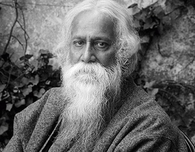
“Don’t take the piss, luv. I’m bleedin’ knackered.” I caught the last part of the mobile phone conversation in the lobby of the Valley Garden Hotel in Sylhet, a bustling city in northeastern Bangladesh. By his dress and skin color, the speaker, a man in his 30s, looked Bangladeshi, but the accent and word choice were purely London. The man picked up his bag and went to the elevator.  He looked as if he’d just arrived after a long flight.

FB cover (2) (600x235).jpg

Which he probably had. There are flights from Heathrow via Dhaka to Sylhet on Biman Bangladesh, the national airline, and other connections via Dubai and Delhi. They serve a community of Bangladeshis—or Sylhetis as they prefer to be called—who have settled in East London since the 19th century. The first came as merchant seamen, hired on in the southern port of Chittagong by British trading ships. When World War One broke out and young British men were conscripted to fight in the trenches, the demand for seamen increased and more Sylhetis took to the seas. Leaving their families was difficult, but they earned more money than they could working in the tea plantations. Between voyages, they lived in cramped quarters in London’s docklands. Some left the ships to take factory jobs and sent money home.

As Muslims, they maintained their culinary practices. In the 1920s, a Sylheti opened a curry shop that became the foundation for a thriving Bengali restaurant industry, centered on Brick Lane in Tower Hamlets. Bengalis of Sylheti origin comprise only 10 per cent of the South Asian population of Britain, but 90 per cent of all South Asian restaurants are Sylheti or Bangla-owned. Of course, the Brick Lane entrepreneurs adapted to British taste and climate, cutting down on the heat and spices. But they have been remarkably successful. Today, the Bangladeshi restaurant industry is estimated to be worth $6 billion a year.

Brick Lane, Tower Hamlets, London

Brick Lane, Tower Hamlets, London

Some of that money comes home to Sylhet in the form of remittances to support family members. It goes towards medical and educational expenses, and daily living needs. British Bangladeshis have built mansions outside the city to use when they visit. Most of the time, a colleague told me, they stand empty, with a guard, a maid and a gardener on staff. In a society where, despite its Muslim principles, material possessions are valued, the mansions represent a family’s social standing—a concrete (or usually brick) status symbol in a region where many people remain desperately poor.

BD divisions.jpg

According to economic statistics, Sylhet Division is the wealthiest region of Bangladesh outside Dhaka. But the wealth is unevenly distributed and the region lags behind others on indicators for health, nutrition and education. On the tea plantations, many workers are from the Indian states of Orissa and Bihar. They are the descendants of workers brought in by the British during the colonial era; they have struggled to preserve their Hindu religion and native languages and have never fully integrated into Sylheti society. 

Sylhet+tea+gardens.jpg

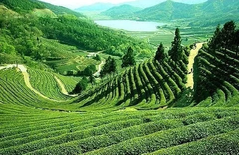
The tea plantations—or tea gardens, as they are somewhat romantically termed in Bangladesh—stretch across the low hills along the road from the airport to the city.  Compared with the rest of the country, the region’s climate is cooler and wetter, making it (like its northern Indian neighbor, the state of Assam), ideal for growing tea, most of it for export.

Bordered on the north by the Indian state of Meghalaya and on the east by the state of Manipur, the Sylhet region is among the most ethnically diverse in the country, with villages of Manipuri, Khasis and Tripura people in the hills, practicing Hinduism, Buddhism and Christianity. The region has its own language, Sylhoti, with ties to both Bangla and Assamese. My travel guide claims Sylhoti has over 10 million speakers worldwide, some of them in East London.

The day my UNICEF colleague Yasmin Khan and I arrived, there was a hartal—a strike by transport workers protesting at an increase in the price of Compressed Natural Gas (CNG), which fuels all the auto rickshaws and many buses, trucks and cars. UNICEF’s security people had warned us to be careful because some roads had been blocked by strikers, but the main road was clear and mercifully free of traffic, so we reached the hotel in what our driver assured us was record time. Still, there was trouble elsewhere; the Sunday newspaper carried a picture of a government official’s SUV that was damaged by strikers. By early evening, the strike was over and Sylhet returned to its normal traffic congestion, its narrow streets clogged with auto rickshaws, bicycle rickshaws, vans and trucks.  Sylhet is a major shopping destination, with some of the best discount clothing outlets in the country.  Many British Bangladeshis (perhaps including the man in the hotel) come here on shopping trips; after paying for the flight and excess baggage, they’ll still come out ahead compared with shopping in the UK.


Land of rivers

For a small country, close in size to its near neighbor, Nepal, or about the size of Illinois or Iowa, Bangladesh has an exceptionally large number of rivers, around 700 according to most estimates. Roughly 10 per cent of its land area is water, a high proportion considering that it has no large lakes. In other words, most of that water is moving, at least in the monsoon season. And when Bangladesh floods, as much as one third of its land area may be under water. The rivers are constantly shifting course, creating new channels or distributaries, making accurate mapping a frustrating exercise.

River map.gif

Three major river systems combine and empty into the Bay of Bengal. After flowing across the Indian state of Assam, the Brahmaputra turns south to enter Bangladesh where it is called the Jamuna. The second system is the Padma, the name given to the Ganges in Bangladesh. The third river system, the Meghna, also brings together rivers flowing out of India’s northeast. The combined waters of the Padma and western Jamuna join the Meghna south of Dhaka to form the Lower Meghna. At its widest point, the Lower Meghna is almost eight miles across, land, river and ocean merging into one hazy landscape. A maze of channels and distributaries combine into the great Gangetic Delta. At 23,000 square miles, it’s the largest delta in the world—the size of Lake Huron or almost as large as the state of West Virginia. The delta is ground zero for climate change, with floods and cyclones blowing up from the Bay of Bengal to submerge low-lying islands and push brackish saltwater inland. 

Barisal ghat 9.jpg

For Bangladesh’s rural population, the river is interwoven with every aspect of their lives. It sustains agriculture—rice paddies, fields of corn, mango orchards, fish and shrimp farms, herds of cattle, and flocks of ducks. It is the main highway for commerce, with nouka carrying fruit, vegetables, livestock, and building materials. In many places, you need to travel by river to reach the school, the health clinic or the government office.

The river, its seasons and rhythms, are common themes in Bangla literature. They figure prominently in the novels, short stories, plays, poems and songs of Rabindranath Tagore (1861-1941), a leading figure in the Bengal Renaissance and the first non-European to win the Nobel Prize for Literature in 1913.

Tagore.jpg

As a zamindar—a hereditary landlord with the right to collect taxes from farmers—he and his entourage cruised the Padma and its tributaries on the well-appointed family houseboat. He witnessed the grinding poverty of rural Bengal and studied its folk traditions and songs. Several works from this period focus on the river, both literally and metaphorically, as in his famous poem, The Golden Boat (1894):

Clouds rumbling in the sky; teeming rain.
I sit on the river bank, sad and alone.
The sheaves lie gathered, harvest has ended,
The river is swollen and fierce in its flow.
As we cut the paddy it started to rain. 

Who is this, steering close to the shore
Singing? I feel that she is someone I know.
The sails are filled wide, she gazes ahead,
Waves break helplessly against the boat each side.
I watch and feel I have seen her face before. 

Oh, to what foreign land do you sail?
Come to the bank and moor your boat for a while.
Go where you want to, give where you care to,
But come to the bank a moment, show your smile -
Take away my golden paddy when you sail. 

For Tagore, the river was more than a setting for tales of love won and lost, or a place to marvel at the beauty and power of nature. From the 1920s, he became increasingly involved in social and political causes. He supported Indian independence while denouncing the elitism of its educated, urban leaders who, he felt, put political goals ahead of relieving poverty and suffering. In his later works, the river becomes a metaphor for class and social justice. In the poem Kopai, he compares a small river “intimate with the villages” where “the land and water exist in no hostility” to the majestic Padma, which is indifferent to humanity:

She’s different. She flows by the localities,

She tolerates them but does not acknowledge;

Pure is her aristocratic rhythm.

FB cover (2) (600x235).jpg

Across the wide Jamuna

For centuries, the Jamuna, the name given to the Brahmaputra in Bangladesh, had, like Tagore’s Padma, its own “aristocratic rhythm,” dividing the country vertically into two nearly equal halves. It was both a highway and a barrier to travel and trade. The only east-west links were by ferries carrying vehicles, rail cars, freight and passengers. Ferry traffic depended on navigability; in rough weather or in the dry season, east-west commerce was practically halted.

Soon after partition in 1947, political parties and businesses began campaigning for a bridge across the Jamuna. Consultants were hired, feasibility studies commissioned, and committees appointed. The project was abandoned more than once. By 1982, the estimated cost had climbed from $175 to $420 million. The clincher was to make it a multipurpose bridge, carrying a two-lane roadway, a dual-gauge railroad line, a natural gas pipeline and power and telecommunications lines. It was named the Bangabandhu Bridge, in honor of the hero of the independence movement, Sheikh Mujibur Rahman, known popularly as Bangabandhu (Friend of Bengal). By the time his daughter and then-president Sheikh Hasina opened it in 1998, the cost had risen to almost $700 million.

Bangabandhu Bridge.jpg

Building the bridge meant taming the river. Records showed that at flood stage, the Jamuna could stretch almost nine miles across. A nine-mile bridge was not in anyone’s cost calculations, so engineers built a channel to confine the Jamuna, keeping the bridge length down to 3 ½ miles. Construction required anchoring 49 spans in the river bed, and building east and west viaducts, each with 12 spans. When opened, it was the 11th longest bridge in the world.