google8d2f7fffcdc71abe.html

Bay of Bengal

Slow boat from Barisal

Since the Mughal period, Barisal, on the west bank of the Kirtankhola, a distributary of the Lower Meghna, has been an important port. The commercial gateway to the southwest delta, Barisal has been described as the “Venice of Bengal” or “Venice of the East,” although if you’re just counting waterways, almost any large town in southwestern Bangladesh is a Venice.

FB cover (2) (600x235).jpg

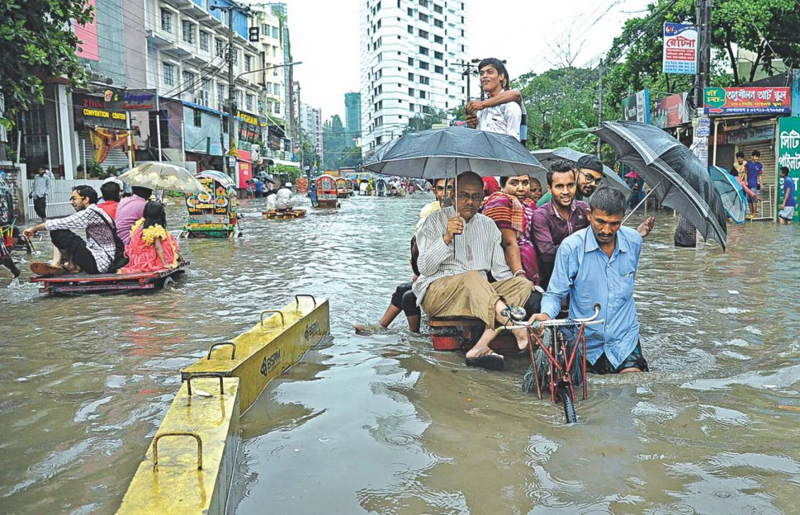
The Kirtankhola channel is not deep enough for the ocean-going cargo ships that steam up the Lower Meghna from the Bay of Bengal, but it can handle smaller freighters that ply between the towns of the delta region, carrying bricks, building materials and bulk agricultural produce. Motorized nouka deliver fruit, vegetables and fish to villages, and ferry passengers, bicycles and animals across the rivers; the catamaran version—two nouka with a wooden platform—is large enough to carry a couple of vehicles. There’s a new road bridge across the Kirtankhola at Barisal, but most rivers and channels are not bridged, and ferries are the only way to avoid a long journey on dirt roads. 

Barisal+ghat+5.jpg

I had flown to Barisal from Dhaka but decided to take the boat back. After meetings at the local university and medical college, my UNICEF host, Sanjit Kumar Das, took me home to his apartment to meet his family. His wife had not only prepared desserts but made up snacks for my return trip to Dhaka. Sanjit had booked me on the 3:00 p.m. Green Line Waterways launch. “You’ll be on the launch for at least seven hours,” he said.  “You can buy food on board, but this will keep you going.”

Launch+3.jpg

In the Bangla transportation vocabulary, the English word “launch,” derived from the Spanish lancha (barge), is not what you’d expect—one of those sleek party boats that line marinas in Florida, or the kind of patrol boat the coastguard and police use to chase drug runners. The Bangladesh “launch,” often four decks high, carries several hundred passengers, and sometimes vehicles and cargo. One type looks like a modern ferry—the kind you’d take across the English Channel, but without the drunken football fans in the bar—while another looks like a Mississippi sternwheeler, all open decks and verandahs but without the stern wheel. From Dhaka’s Sadarghat ferry terminal, launches to southern destinations—Khulna, Barisal, Patuakhali and islands of the delta—leave in the early evening, and offer comfortable cabins with air conditioning. I haven’t done the trip this way, but travelers tell me it’s exhilarating to leave behind the noise and pollution of the capital and float off into the sunset.

Sanjit & daughter.jpg

At the Barisal ghat, Sanjit and his daughter guided me through the stalls selling street food, snacks, fruit and vegetables. Three launches were moored, and Sanjit wanted to make sure I boarded the right one. I stood on the top deck and waved goodbye. Below me, nouka glided in and out of the ghat, carrying passengers, bicycles, motorbikes, yellow water barrels and fruit and vegetables. Small boys jumped into the water, splashed around and climbed back up the wooden pillars supporting the quay.

Barisal ghat 6.jpg

A man emerged from the launch’s kitchen and laid a long blue rug on the open deck. Passengers would need to pray during the trip. I wondered if someone with a compass or a smart phone was appointed to adjust the arrow to Mecca to the meanders on the river.

After several blasts from the launch’s horn, we cast off.  For an hour or so, I stood on the open deck enjoying the breeze and watching life on the Kirtankhola—the shore line of coconut palms, bananas, mango trees and small settlements, fishermen casting their nets, cattle grazing on low, grassy islands. We passed small freighters heading downstream with loads of gravel, bricks and sand, and nouka crossing the river. After two hours, we joined the Lower Meghna and the shoreline disappeared into the late afternoon haze. There wasn’t much to look at except for larger cargo ships and swooping seagulls, so I retreated to the air-conditioned upper deck. It was a midweek departure, so I had my choice of seats. A steward brought me tea and I settled down to read a book and make some travel notes.

It was difficult to concentrate because of the constant chatter from the TV monitors, occasionally interrupted by gun shots and car crashes. Green TV was offering a steady stream of Bangla-language movies with routine plots and stock characters. The Dhallywood (Dhaka-based) movie industry is not as large or well renowned as its Indian big brother, Bollywood, but it has perfected the mass production process, churning out hundreds of movies a year for domestic audiences and the Bangladeshi diaspora in the Middle East, Malaysia and the UK. There were shoot-outs on city streets, car chases, and love scenes on beaches and green mountain pastures, the characters’ slow-motion passions enhanced by rain, mist and other artificial weather elements. Most characters appeared to change clothes every couple of minutes, the women dressed in bright colors, the men with slicked black hair usually dressed in smart suits and sporting sunglasses, even during night scenes.

It was night by the time we reached the Buriganga River, the channel of the Padma that flows through Dhaka. We passed overnight launches heading south, their deck lights illuminating them against the dark water. Many passengers were on deck, enjoying the cool night air. We docked at Sadarghat, and I emerged into the maze of Old Dhaka, the streets crowded with auto-rickshaws, trucks, buses and people. I was already missing the river.   


All at sea in Chittagong

“Can you give me a window seat on the left side of the plane?” I asked the Novoair agent at Chittagong airport as I checked in for the return flight to Dhaka. I usually request an aisle seat to get a few extra inches of legroom, but it was going to be a short, 50-minute flight and I hoped for a good view of the Bay of Bengal as the plane headed northwest. I had read newspaper reports of major back-ups at Chittagong’s container terminals and expected to see a few ships anchored, waiting to enter the estuary of the Karnaphuli River. I wasn’t disappointed. Through the patchy clouds I could see dozens of container ships at anchor over a wide area. Between them, like smalls insects, were the black dots of fishing boats.

FB cover (2) (600x235).jpg

There’s a vigorous and usually good-natured debate between residents of Bangladesh’s capital, Dhaka, and its second-largest city, Chittagong, about which has the worst traffic jams. I’m not going to take a position on this one, but I’m pretty confident in saying that Chittagong’s largely unseen jam--the shipping back-up--may have the greater effect on the economy. I’m no maritime expert, but it’s evident that if a large container ship has to park in the Bay of Bengal and wait up to a week to get into port, then someone (and probably more than one person) is losing money. The scene from the plane window is a tranquil one, but the economic effects are real.

Chittagong’s natural harbor, noted as early as the 1st century AD by the Roman geographer Ptolemy as one of the major seaports in the East, was the ancient gateway to Bengal. From the 9th century, Arab traders became prominent in the city’s commercial life, and introduced Islam to the region. They were later joined by Portuguese traders. In the colonial era, the British built railroads to link Chittagong to Calcutta (Kolkata) and other cities in India. Today, it is a major industrial and commercial center, with the Bangladesh Navy’s largest base. It’s estimated that roughly 90 percent of the country’s seaborne trade passes through Chittagong. With China now Bangladesh’s largest trading partner, efforts are underway, under the so-called Belt and Road Initiative, to build rail and road links from southern Yunnan province to the port. With direct access to the Indian Ocean, China will no longer be dependent on shipping through the Straits of Malacca, between Malaysia and the Indonesian island of Sumatra, a narrow seaway that can easily be blockaded in time of war.

CTG 3.jpg

Chittagong, with a population of about seven million, is still a city of heavy industry--think of Cleveland or Sheffield before the steel mills closed, and the cities rebranded themselves as commercial centers and scuzzied up the downtown areas with boutiques and tapas bars. It is a major steel producer, importing iron ore and coal and recycling scrap from shipbreaking yards along the coast. It has textile and cement factories, and others processing agricultural produce. Truck traffic is heavy. In Dhaka, trucks are banned from the metropolitan area during daytime hours, but in Chittagong the major port roads are clogged at all hours with yellow Tata and Leyland trucks carrying containers, fuel and other cargoes. Fortunately, most of them run on compressed natural gas (CNG); otherwise, the city’s pollution problems would be a lot worse.

Slow going in Chittagong, April 2017 (photograph courtesy of Daily Star). As is the traffic wasn’t already bad enough, the city also regularly suffers from flooding.

Slow going in Chittagong, April 2017 (photograph courtesy of Daily Star). As is the traffic wasn’t already bad enough, the city also regularly suffers from flooding.

You don’t even need to leave the airport to get a sense of Chittagong self-image. At many airports around the world, the display ads and video screens pitch high-priced luxury goods and financial services. Not at Chittagong. In the check-in area, the major visual competition is between two cement companies. You are invited to “Trust in Confidence Cement, an A grade clinker” (whatever that means) or in Ruby Cement, part of the Heidelberg Cement Group. Both feature images of projects that stand tall because of the cement used--hotels, commercial buildings, bridges, tunnels, power plants, overpasses (flyovers). Between them is a screen displaying what holds all this concrete together. The KSRM steel company, “Your Steel Partner,” claims to build “Future Bangladesh on a firm foundation.” You can even upgrade to KSRM Premium “for colossal construction. The video screen features computer animations of bridges, overpasses, and cloverleafs with high-speed trains speeding over almost empty highways. KSRM has a claim to fame because its steel is being used for construction of the major bridge across the Padma (Ganges) which will at last provide a direct road and rail link between the east and west of the country, but it is also a utopian, animated dream of a future Bangladesh without traffic congestion.   

 My hotel was close to GEC Circle in the city center, where several main roads meet, and the traffic backs up at most hours of the day. GEC is the name given to the newer part of Chittagong, north of the old city and the river. I wondered why this major commercial area had such a prosaic name, rather than the name of a major figure in the city’s history. A university colleague explained: “General Electric once had its corporate headquarters here. It was a landmark, so the everyone called the area GEC.”  General Electric is long gone. There’s also a CDA Avenue  but that’s more easily explained--it stands for Chittagong Development Authority. One night, I wandered around the circle. It’s lined with stalls selling cheap clothes, fruits and vegetables, fresh fish, tea stands, and booths selling mobile phone recharges. Behind the circle are arcades of small shops selling bakery goods and sweet desserts, jewelry, lighting fixtures, saris, electronics, and pharmacy products. At 11:00 p.m., the streets were full of people, walking, shopping and getting on and off the bicycle rickshaws.

GEC Circle

GEC Circle

The two universities where I met with faculty and administrators and made presentations to students on communication and development offered a contrast in location, facilities and style. Port City International University, a six-year-old private university a mile or so from GEC Circle, is in the Khulshi Hills, a leafy upscale residential area with high walls, guard houses and security systems. Compared with Dhaka, which is flat as a pancake, Chittagong has some gentle rises but to call them “hills” is an overstatement. Khulshi Hills is about as elevated as those Cleveland suburbs a couple of miles from Lake Erie that call themselves “Heights” because they’re a couple of hundred feet above lake level.

 The university has 6,000 students and a new campus under construction, At the entrance, two sentries snapped to attention and saluted. I was greeted by an entourage of faculty and students and walked slowly so that the photographer could keep in front of me, taking shots of me chatting with the welcome committee. At the opening ceremony, I sat on a dais, partly obscured from the audience by the large flower display on the table. Later, I was presented with a bouquet and a fancy plaque with my name on it.

Chittagong University, a public institution with about 25,000 students, is in a semi-rural setting about an hour’s drive, depending on traffic, from the city center. “There are monkeys and snakes in the forest,” my UNICEF companion Hasan warned me. Muhammad Yunus, the Bangladeshi social entrepreneur, economist and civil society leader, who was awarded the Nobel Peace Prize in 2006 for founding the Grameen Bank and pioneering the concepts of microfinance and microcredit, studied and taught at the university. Hasan told me that he piloted his development projects in villages surrounding the university. The Faculty of Social Science building, where I met with faculty in communication and taught a class of 4th year and masters students, is named for him.

CTG+U+7.jpg

The facilities are similar to those at other public universities in Bangladesh--aging, concrete academic buildings, with the paint peeling from the heat and monsoon rains, large classrooms where three students squeezed together on each wooden desk, and faculty offices with padlocks on the doors. Yet it has attracted talented faculty who are dedicated to their work, and I enjoyed my conversations with them.

CTG U 8.jpg

The university has long been a center of student political activism. While I was meeting with the Vice Chancellor, a group of students was staging a noisy protest outside the administration building. I asked one faculty member about the graffiti on the walls of the academic buildings.  She said the names and symbols represented student groups or clubs. Because the university is so far outside the city, most students commute by train to a special station on the campus. “The students travel together, and they give their group a name,” she explained. I asked if the so-called clubs had a political as well as a social side. She smiled but did not answer directly. “There have been a number of research studies done on their activities,” she added guardedly. I think I know what she was trying to tell me.


Exploring Old Dhaka

Even with a guidebook, I was not ready to single-handedly tackle Old Dhaka, with its winding, unnamed streets and back alleys. I called Taimur Islam, director of the Urban Study Group (USG), a non-profit outfit that offers walking tours. He said the morning tour had already left, but that he would see if I could join the group. He called back a few minutes later. I passed the phone to my auto-rickshaw driver and Taimur gave him directions. We set off on a harrowing, bumpy ride through the narrow streets.

FB cover (2) (600x235).jpg

I met Ana, a USG volunteer guide, at a 19th century merchant’s home, built in brick in the British colonial style with colonnades and balconies. Like most historic structures in Old Dhaka, it was in serious need of restoration. Years of baking heat and monsoon rains had taken their toll. The stucco had peeled off the walls and columns, exposing the brick, and the wooden balconies sagged. Small trees sprouted out of cracks and gutters.

Old Dhaka, wedged between the commercial center of Bangladesh’s densely populated  capital city and the River Buriganga, began its life as a river port with bazaars. From the 17th century, under India’s Mughal emperors, it became the most important commercial center in East Bengal, producing and exporting muslin, a high-quality woven cotton. Dhaka thrived until the 19th century, when British merchants took advantage of favorable tariffs to flood the market with imported cotton goods, sending the local industry into decline. It was cheaper to buy shirts from the mills of Manchester than to produce them at home.

Entrance to Shakhari bazaar

Entrance to Shakhari bazaar

The city attracted Bengali Hindu artisans who lived peacefully alongside their Muslim neighbors. On March 26, 1971, when Pakistan’s army launched its offensive to put down the independence movement in what was then East Pakistan, politicians and clerics declared they were fighting a “holy war” to defend Islam. The army targeted the Shakhari bazaar, killing hundreds. Some Hindus fled to India, but many stayed. Their storefronts spill onto the bazaar’s narrow central street; down side alleys, in workshops squeezed between small Hindu temples, artisans fashion bangles and jewelry from metal and conch shells.  

In 2004, an old building in the bazaar collapsed. The government, supported by developers who saw an opportunity to grab prime real estate, proposed that many historic buildings, some from the colonial era, be demolished for safety reasons. Historians and conservationists were outraged, arguing the city’s cultural heritage would be destroyed. The controversy was the impetus for the founding of the USG by Taimur, a trained architect. The group campaigned to have streets and buildings designated as historically significant, and so protected from demolition. Some building owners opposed the designation, saying they did not have the money to maintain or restore their properties. The debate over preserving Old Dhaka echoes conflicts in other cities, with government agencies, developers, property owners and preservationists taking their disputes to the courts and the media.

The USG may have met its original goal of saving the buildings from demolition but restoring them will be a longer struggle. Landlords are unwilling to throw out tenants, lose rental income and invest in restoration. In Western countries, a government agency might buy the buildings and restore them, but in Bangladesh the government has other priorities. It’s difficult to argue for public funds for historic restoration when schools and health clinics are under-staffed, roads need to be repaired, and flood levees built.

The Water Palace, Old Dhaka

The Water Palace, Old Dhaka

On the bank of the Buriganga River, a former merchant’s mansion, the Water Palace, is in a dilapidated state. It houses families of the Army Corps of Engineers, one of the government agencies that provides free or low-cost housing to staff, partly to compensate for their low salaries. We stood in the central courtyard, looking up at washing draped over the balconies as children played hide-and-seek among the pillars and narrow passageways.

Old Dhaka 23.jpg

One part of the palace has been taken over by Old Dhaka’s spice bazaar. From the mid-18th century, the French and British East India companies competed for the export trade in turmeric, ginger, garlic, chili, and other spices. The French were kicked out in 1757 after their ally, the Nawab of Bengal, was defeated by Major-General Robert Clive at the Battle of Plassey. The victory allowed the British East India Company to take over most of Bengal, and then expand its control across the sub-continent. In Old Dhaka’s Farashganj (the name is a corruption of Frenchganj, meaning French market-town), the merchants left behind stylish mansions with balconies and wrought-iron balustrades.

French quarter.jpg

From the rambling Chowk bazaar, which for four centuries has been the city’s main wholesale market for fruit and vegetables, we emerged at the busy Buriganga waterfront. Bangladesh is dissected by more than 700 rivers; although its highway system has been improved, much of its commerce and many of its people still move by water.

Buriganga 4.jpg

Three-deck ferries (called launches) were lined up, waiting to take on passengers and cargo for destinations in the southern delta, where three major river systems, the Jamuna (Brahmaputra), Padma (Ganges) and Meghna, empty into the Bay of Bengal. Small cargo freighters loaded with building materials sat at anchor, ready to unload. On the south side of the river, freighters were hauled up on the bank for repairs; workers clambered over the hulls and decks, the sparks from their acetylene torches flashing. Motorized wooden nouka, the traditional Bengali river craft with a flat bottom and high prow, loaded with pumpkins, gourds, cauliflowers and coconuts, sacks of onions, garlic, potatoes, chilis and mangoes, were pulled up on the bank near the bazaar. Porters piled the produce into broad baskets and formed a human chain, carrying them on their heads and passing on to the next link.

There is no bridge over the Buriganga. The only way  to cross is in a narrow nouka, poled by a boatman. One USG volunteer asked if I would like to take a trip.  I looked at the wobbling craft and the dirty water. “I think I’ll just stick with the walking tour,” I said.  


Land of rivers

For a small country, close in size to its near neighbor, Nepal, or about the size of Illinois or Iowa, Bangladesh has an exceptionally large number of rivers, around 700 according to most estimates. Roughly 10 per cent of its land area is water, a high proportion considering that it has no large lakes. In other words, most of that water is moving, at least in the monsoon season. And when Bangladesh floods, as much as one third of its land area may be under water. The rivers are constantly shifting course, creating new channels or distributaries, making accurate mapping a frustrating exercise.

River map.gif

Three major river systems combine and empty into the Bay of Bengal. After flowing across the Indian state of Assam, the Brahmaputra turns south to enter Bangladesh where it is called the Jamuna. The second system is the Padma, the name given to the Ganges in Bangladesh. The third river system, the Meghna, also brings together rivers flowing out of India’s northeast. The combined waters of the Padma and western Jamuna join the Meghna south of Dhaka to form the Lower Meghna. At its widest point, the Lower Meghna is almost eight miles across, land, river and ocean merging into one hazy landscape. A maze of channels and distributaries combine into the great Gangetic Delta. At 23,000 square miles, it’s the largest delta in the world—the size of Lake Huron or almost as large as the state of West Virginia. The delta is ground zero for climate change, with floods and cyclones blowing up from the Bay of Bengal to submerge low-lying islands and push brackish saltwater inland. 

Barisal ghat 9.jpg

For Bangladesh’s rural population, the river is interwoven with every aspect of their lives. It sustains agriculture—rice paddies, fields of corn, mango orchards, fish and shrimp farms, herds of cattle, and flocks of ducks. It is the main highway for commerce, with nouka carrying fruit, vegetables, livestock, and building materials. In many places, you need to travel by river to reach the school, the health clinic or the government office.

The river, its seasons and rhythms, are common themes in Bangla literature. They figure prominently in the novels, short stories, plays, poems and songs of Rabindranath Tagore (1861-1941), a leading figure in the Bengal Renaissance and the first non-European to win the Nobel Prize for Literature in 1913.

Tagore.jpg

As a zamindar—a hereditary landlord with the right to collect taxes from farmers—he and his entourage cruised the Padma and its tributaries on the well-appointed family houseboat. He witnessed the grinding poverty of rural Bengal and studied its folk traditions and songs. Several works from this period focus on the river, both literally and metaphorically, as in his famous poem, The Golden Boat (1894):

Clouds rumbling in the sky; teeming rain.
I sit on the river bank, sad and alone.
The sheaves lie gathered, harvest has ended,
The river is swollen and fierce in its flow.
As we cut the paddy it started to rain. 

Who is this, steering close to the shore
Singing? I feel that she is someone I know.
The sails are filled wide, she gazes ahead,
Waves break helplessly against the boat each side.
I watch and feel I have seen her face before. 

Oh, to what foreign land do you sail?
Come to the bank and moor your boat for a while.
Go where you want to, give where you care to,
But come to the bank a moment, show your smile -
Take away my golden paddy when you sail. 

For Tagore, the river was more than a setting for tales of love won and lost, or a place to marvel at the beauty and power of nature. From the 1920s, he became increasingly involved in social and political causes. He supported Indian independence while denouncing the elitism of its educated, urban leaders who, he felt, put political goals ahead of relieving poverty and suffering. In his later works, the river becomes a metaphor for class and social justice. In the poem Kopai, he compares a small river “intimate with the villages” where “the land and water exist in no hostility” to the majestic Padma, which is indifferent to humanity:

She’s different. She flows by the localities,

She tolerates them but does not acknowledge;

Pure is her aristocratic rhythm.

FB cover (2) (600x235).jpg

Across the wide Jamuna

For centuries, the Jamuna, the name given to the Brahmaputra in Bangladesh, had, like Tagore’s Padma, its own “aristocratic rhythm,” dividing the country vertically into two nearly equal halves. It was both a highway and a barrier to travel and trade. The only east-west links were by ferries carrying vehicles, rail cars, freight and passengers. Ferry traffic depended on navigability; in rough weather or in the dry season, east-west commerce was practically halted.

Soon after partition in 1947, political parties and businesses began campaigning for a bridge across the Jamuna. Consultants were hired, feasibility studies commissioned, and committees appointed. The project was abandoned more than once. By 1982, the estimated cost had climbed from $175 to $420 million. The clincher was to make it a multipurpose bridge, carrying a two-lane roadway, a dual-gauge railroad line, a natural gas pipeline and power and telecommunications lines. It was named the Bangabandhu Bridge, in honor of the hero of the independence movement, Sheikh Mujibur Rahman, known popularly as Bangabandhu (Friend of Bengal). By the time his daughter and then-president Sheikh Hasina opened it in 1998, the cost had risen to almost $700 million.

Bangabandhu Bridge.jpg

Building the bridge meant taming the river. Records showed that at flood stage, the Jamuna could stretch almost nine miles across. A nine-mile bridge was not in anyone’s cost calculations, so engineers built a channel to confine the Jamuna, keeping the bridge length down to 3 ½ miles. Construction required anchoring 49 spans in the river bed, and building east and west viaducts, each with 12 spans. When opened, it was the 11th longest bridge in the world.