“Can you give me a window seat on the left side of the plane?” I asked the Novoair agent at Chittagong airport as I checked in for the return flight to Dhaka. I usually request an aisle seat to get a few extra inches of legroom, but it was going to be a short, 50-minute flight and I hoped for a good view of the Bay of Bengal as the plane headed northwest. I had read newspaper reports of major back-ups at Chittagong’s container terminals and expected to see a few ships anchored, waiting to enter the estuary of the Karnaphuli River. I wasn’t disappointed. Through the patchy clouds I could see dozens of container ships at anchor over a wide area. Between them, like smalls insects, were the black dots of fishing boats.

There’s a vigorous and usually good-natured debate between residents of Bangladesh’s capital, Dhaka, and its second-largest city, Chittagong, about which has the worst traffic jams. I’m not going to take a position on this one, but I’m pretty confident in saying that Chittagong’s largely unseen jam--the shipping back-up--may have the greater effect on the economy. I’m no maritime expert, but it’s evident that if a large container ship has to park in the Bay of Bengal and wait up to a week to get into port, then someone (and probably more than one person) is losing money. The scene from the plane window is a tranquil one, but the economic effects are real.
Chittagong’s natural harbor, noted as early as the 1st century AD by the Roman geographer Ptolemy as one of the major seaports in the East, was the ancient gateway to Bengal. From the 9th century, Arab traders became prominent in the city’s commercial life, and introduced Islam to the region. They were later joined by Portuguese traders. In the colonial era, the British built railroads to link Chittagong to Calcutta (Kolkata) and other cities in India. Today, it is a major industrial and commercial center, with the Bangladesh Navy’s largest base. It’s estimated that roughly 90 percent of the country’s seaborne trade passes through Chittagong. With China now Bangladesh’s largest trading partner, efforts are underway, under the so-called Belt and Road Initiative, to build rail and road links from southern Yunnan province to the port. With direct access to the Indian Ocean, China will no longer be dependent on shipping through the Straits of Malacca, between Malaysia and the Indonesian island of Sumatra, a narrow seaway that can easily be blockaded in time of war.

Chittagong, with a population of about seven million, is still a city of heavy industry--think of Cleveland or Sheffield before the steel mills closed, and the cities rebranded themselves as commercial centers and scuzzied up the downtown areas with boutiques and tapas bars. It is a major steel producer, importing iron ore and coal and recycling scrap from shipbreaking yards along the coast. It has textile and cement factories, and others processing agricultural produce. Truck traffic is heavy. In Dhaka, trucks are banned from the metropolitan area during daytime hours, but in Chittagong the major port roads are clogged at all hours with yellow Tata and Leyland trucks carrying containers, fuel and other cargoes. Fortunately, most of them run on compressed natural gas (CNG); otherwise, the city’s pollution problems would be a lot worse.
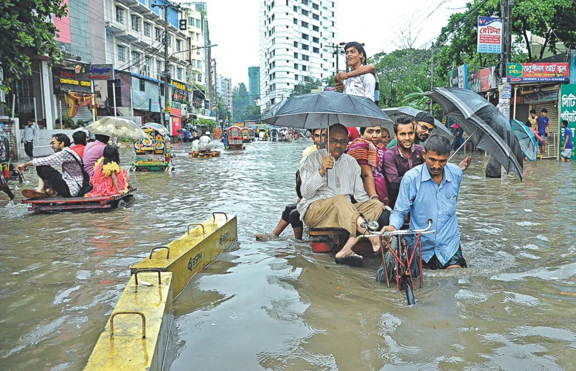
Slow going in Chittagong, April 2017 (photograph courtesy of Daily Star). As is the traffic wasn’t already bad enough, the city also regularly suffers from flooding.
You don’t even need to leave the airport to get a sense of Chittagong self-image. At many airports around the world, the display ads and video screens pitch high-priced luxury goods and financial services. Not at Chittagong. In the check-in area, the major visual competition is between two cement companies. You are invited to “Trust in Confidence Cement, an A grade clinker” (whatever that means) or in Ruby Cement, part of the Heidelberg Cement Group. Both feature images of projects that stand tall because of the cement used--hotels, commercial buildings, bridges, tunnels, power plants, overpasses (flyovers). Between them is a screen displaying what holds all this concrete together. The KSRM steel company, “Your Steel Partner,” claims to build “Future Bangladesh on a firm foundation.” You can even upgrade to KSRM Premium “for colossal construction. The video screen features computer animations of bridges, overpasses, and cloverleafs with high-speed trains speeding over almost empty highways. KSRM has a claim to fame because its steel is being used for construction of the major bridge across the Padma (Ganges) which will at last provide a direct road and rail link between the east and west of the country, but it is also a utopian, animated dream of a future Bangladesh without traffic congestion.
My hotel was close to GEC Circle in the city center, where several main roads meet, and the traffic backs up at most hours of the day. GEC is the name given to the newer part of Chittagong, north of the old city and the river. I wondered why this major commercial area had such a prosaic name, rather than the name of a major figure in the city’s history. A university colleague explained: “General Electric once had its corporate headquarters here. It was a landmark, so the everyone called the area GEC.” General Electric is long gone. There’s also a CDA Avenue but that’s more easily explained--it stands for Chittagong Development Authority. One night, I wandered around the circle. It’s lined with stalls selling cheap clothes, fruits and vegetables, fresh fish, tea stands, and booths selling mobile phone recharges. Behind the circle are arcades of small shops selling bakery goods and sweet desserts, jewelry, lighting fixtures, saris, electronics, and pharmacy products. At 11:00 p.m., the streets were full of people, walking, shopping and getting on and off the bicycle rickshaws.

GEC Circle
The two universities where I met with faculty and administrators and made presentations to students on communication and development offered a contrast in location, facilities and style. Port City International University, a six-year-old private university a mile or so from GEC Circle, is in the Khulshi Hills, a leafy upscale residential area with high walls, guard houses and security systems. Compared with Dhaka, which is flat as a pancake, Chittagong has some gentle rises but to call them “hills” is an overstatement. Khulshi Hills is about as elevated as those Cleveland suburbs a couple of miles from Lake Erie that call themselves “Heights” because they’re a couple of hundred feet above lake level.
The university has 6,000 students and a new campus under construction, At the entrance, two sentries snapped to attention and saluted. I was greeted by an entourage of faculty and students and walked slowly so that the photographer could keep in front of me, taking shots of me chatting with the welcome committee. At the opening ceremony, I sat on a dais, partly obscured from the audience by the large flower display on the table. Later, I was presented with a bouquet and a fancy plaque with my name on it.
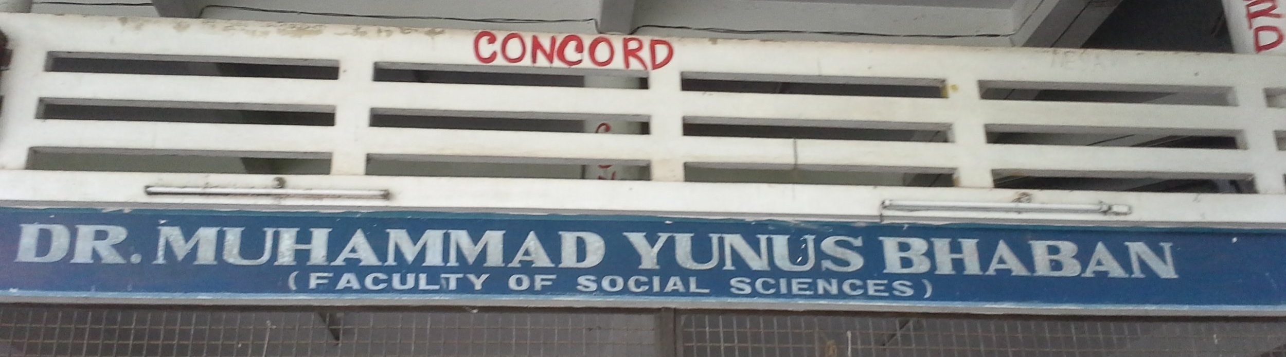
Chittagong University, a public institution with about 25,000 students, is in a semi-rural setting about an hour’s drive, depending on traffic, from the city center. “There are monkeys and snakes in the forest,” my UNICEF companion Hasan warned me. Muhammad Yunus, the Bangladeshi social entrepreneur, economist and civil society leader, who was awarded the Nobel Peace Prize in 2006 for founding the Grameen Bank and pioneering the concepts of microfinance and microcredit, studied and taught at the university. Hasan told me that he piloted his development projects in villages surrounding the university. The Faculty of Social Science building, where I met with faculty in communication and taught a class of 4th year and masters students, is named for him.
The facilities are similar to those at other public universities in Bangladesh--aging, concrete academic buildings, with the paint peeling from the heat and monsoon rains, large classrooms where three students squeezed together on each wooden desk, and faculty offices with padlocks on the doors. Yet it has attracted talented faculty who are dedicated to their work, and I enjoyed my conversations with them.

The university has long been a center of student political activism. While I was meeting with the Vice Chancellor, a group of students was staging a noisy protest outside the administration building. I asked one faculty member about the graffiti on the walls of the academic buildings. She said the names and symbols represented student groups or clubs. Because the university is so far outside the city, most students commute by train to a special station on the campus. “The students travel together, and they give their group a name,” she explained. I asked if the so-called clubs had a political as well as a social side. She smiled but did not answer directly. “There have been a number of research studies done on their activities,” she added guardedly. I think I know what she was trying to tell me.