google8d2f7fffcdc71abe.html

Sheikh Hasina

Vote the pineapple

In Bangladesh, a country with more than 700 rivers, it’s hardly surprising that the symbol of the dominant political party, the Awami League, is a boat—in this case, a traditional river craft with a high prow, the nouka. As in other developing countries, political symbols are important, especially in rural areas where literacy levels are lower than in the cities. Although urban areas are growing, two thirds of the population still live in rural areas. Voters may not be able to read a newspaper or a political poster, but they will recognize the party symbol. Vote the boat.

AL boat symbol.png

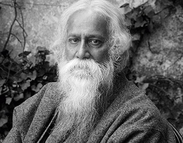
The ruling Awami League (AL) was already in full campaign mode when I visited in September 2018, three months before parliamentary elections,. All over Dhaka, banners and posters featuring the prime minister, Sheikh Hasina, were plastered on billboards, building walls, telephone poles, and almost anything else that could support them. The grandmotherly, bespectacled and always smiling Hasina promised to maintain the country’s impressive pace of economic development.

Sheikh Hasina.jpg

The symbol of the main opposition party, the Bangladesh Nationalist Party (BNP), a sheaf of rice stalks, is also designed to appeal to rural voters. In 2018, no one was giving the BNP much chance. Its ailing leader, Khaleda Zia, was in prison on what her supporters claimed were politically motivated, trumped-up corruption charges; her son was trying to run the party from exile in London.  Although the BNP eventually allied with other opposition groups to contest the election, Sheikh Hasina and the AL, with the help of a little voter intimidation and ballot rigging, emerged victorious.   

There is no accurate count of the number of political parties in Bangladesh. The last British Viceroy, Lord Mountbatten, was quoted as saying: “When you have two Bengalis, you have two political parties. When you have three, you have two parties, each with three wings.”

FB cover (2) (600x235).jpg

Mountbatten’s words rang true to me on my visit to Khulna, the third largest city in the country. Municipal elections were coming up and at key points around the city--major roads and intersections, the bus station, the markets--large banners of candidates competed for attention. They were all (or mostly) men, and they struck serious, unsmiling, I’m-all-about-business poses in their photos.

Khulna+poster+4.jpg

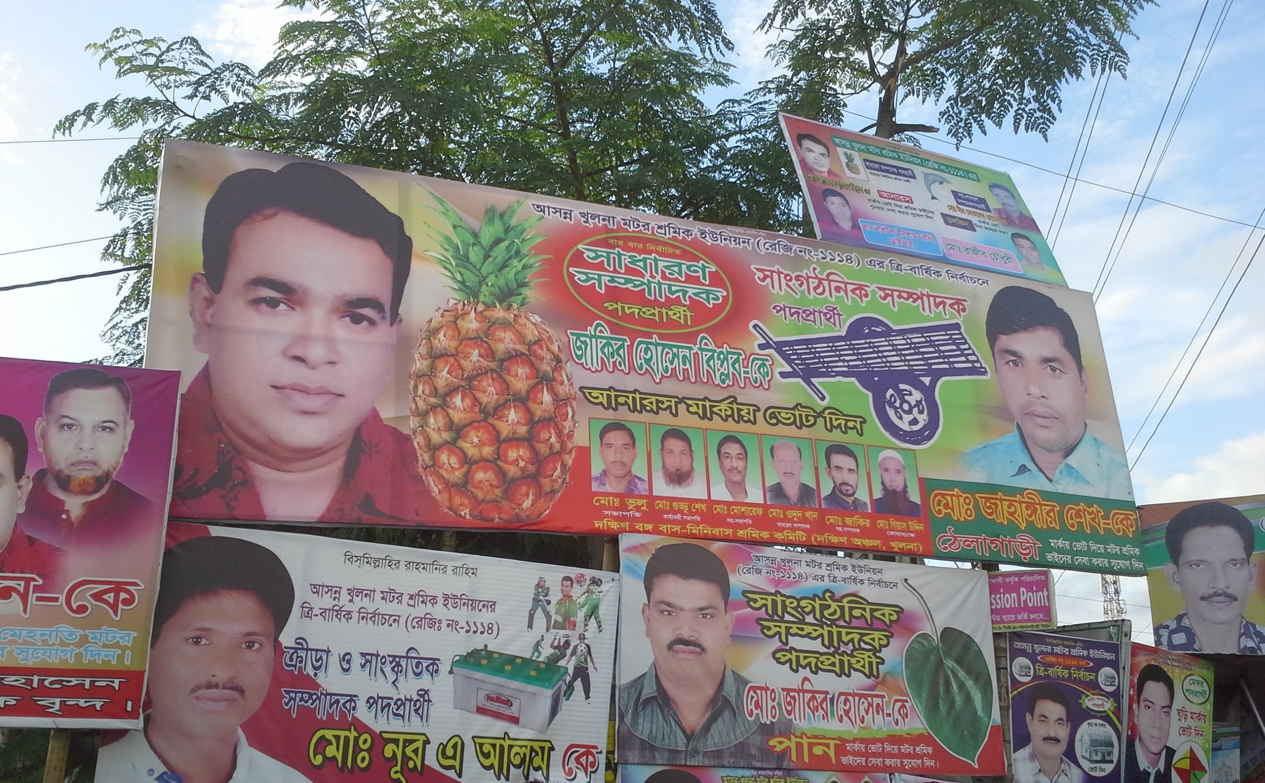
Their parties use a variety of images. The symbol of the local BNP is the pineapple, a metaphor for agriculture or fruitfulness or I don’t know what. As my UNICEF car returned from the university one day, we were halted by a march of BNP loyalists, shouting slogans and holding wooden signs with the candidate’s photo and a pineapple underneath.

Khulna poster 1.jpg

Two parties use images of animals found in the Sundarbans--the large delta region of mangrove forest to the south--so there’s the crocodile party and the dolphin party. This is an agricultural area, so there were rice stalks and a farm cart. One candidate, presumably running on a law and order platform, looked tough and urged voters to cast their ballot for the padlock. Then there was the guy with the wrench, presumably running on an “I’ll fix the problem” platform.

Khulna+poster+3.jpg

At one intersection, a poster showed horses galloping in a field. I hadn’t seen a horse since I arrived. I asked my UNICEF companion Umme Halima what it meant. She shrugged. “I think it’s supposed to suggest that these guys are energetic,” she said.


Land of rivers

For a small country, close in size to its near neighbor, Nepal, or about the size of Illinois or Iowa, Bangladesh has an exceptionally large number of rivers, around 700 according to most estimates. Roughly 10 per cent of its land area is water, a high proportion considering that it has no large lakes. In other words, most of that water is moving, at least in the monsoon season. And when Bangladesh floods, as much as one third of its land area may be under water. The rivers are constantly shifting course, creating new channels or distributaries, making accurate mapping a frustrating exercise.

River map.gif

Three major river systems combine and empty into the Bay of Bengal. After flowing across the Indian state of Assam, the Brahmaputra turns south to enter Bangladesh where it is called the Jamuna. The second system is the Padma, the name given to the Ganges in Bangladesh. The third river system, the Meghna, also brings together rivers flowing out of India’s northeast. The combined waters of the Padma and western Jamuna join the Meghna south of Dhaka to form the Lower Meghna. At its widest point, the Lower Meghna is almost eight miles across, land, river and ocean merging into one hazy landscape. A maze of channels and distributaries combine into the great Gangetic Delta. At 23,000 square miles, it’s the largest delta in the world—the size of Lake Huron or almost as large as the state of West Virginia. The delta is ground zero for climate change, with floods and cyclones blowing up from the Bay of Bengal to submerge low-lying islands and push brackish saltwater inland. 

Barisal ghat 9.jpg

For Bangladesh’s rural population, the river is interwoven with every aspect of their lives. It sustains agriculture—rice paddies, fields of corn, mango orchards, fish and shrimp farms, herds of cattle, and flocks of ducks. It is the main highway for commerce, with nouka carrying fruit, vegetables, livestock, and building materials. In many places, you need to travel by river to reach the school, the health clinic or the government office.

The river, its seasons and rhythms, are common themes in Bangla literature. They figure prominently in the novels, short stories, plays, poems and songs of Rabindranath Tagore (1861-1941), a leading figure in the Bengal Renaissance and the first non-European to win the Nobel Prize for Literature in 1913.

Tagore.jpg

As a zamindar—a hereditary landlord with the right to collect taxes from farmers—he and his entourage cruised the Padma and its tributaries on the well-appointed family houseboat. He witnessed the grinding poverty of rural Bengal and studied its folk traditions and songs. Several works from this period focus on the river, both literally and metaphorically, as in his famous poem, The Golden Boat (1894):

Clouds rumbling in the sky; teeming rain.
I sit on the river bank, sad and alone.
The sheaves lie gathered, harvest has ended,
The river is swollen and fierce in its flow.
As we cut the paddy it started to rain. 

Who is this, steering close to the shore
Singing? I feel that she is someone I know.
The sails are filled wide, she gazes ahead,
Waves break helplessly against the boat each side.
I watch and feel I have seen her face before. 

Oh, to what foreign land do you sail?
Come to the bank and moor your boat for a while.
Go where you want to, give where you care to,
But come to the bank a moment, show your smile -
Take away my golden paddy when you sail. 

For Tagore, the river was more than a setting for tales of love won and lost, or a place to marvel at the beauty and power of nature. From the 1920s, he became increasingly involved in social and political causes. He supported Indian independence while denouncing the elitism of its educated, urban leaders who, he felt, put political goals ahead of relieving poverty and suffering. In his later works, the river becomes a metaphor for class and social justice. In the poem Kopai, he compares a small river “intimate with the villages” where “the land and water exist in no hostility” to the majestic Padma, which is indifferent to humanity:

She’s different. She flows by the localities,

She tolerates them but does not acknowledge;

Pure is her aristocratic rhythm.

FB cover (2) (600x235).jpg

Across the wide Jamuna

For centuries, the Jamuna, the name given to the Brahmaputra in Bangladesh, had, like Tagore’s Padma, its own “aristocratic rhythm,” dividing the country vertically into two nearly equal halves. It was both a highway and a barrier to travel and trade. The only east-west links were by ferries carrying vehicles, rail cars, freight and passengers. Ferry traffic depended on navigability; in rough weather or in the dry season, east-west commerce was practically halted.

Soon after partition in 1947, political parties and businesses began campaigning for a bridge across the Jamuna. Consultants were hired, feasibility studies commissioned, and committees appointed. The project was abandoned more than once. By 1982, the estimated cost had climbed from $175 to $420 million. The clincher was to make it a multipurpose bridge, carrying a two-lane roadway, a dual-gauge railroad line, a natural gas pipeline and power and telecommunications lines. It was named the Bangabandhu Bridge, in honor of the hero of the independence movement, Sheikh Mujibur Rahman, known popularly as Bangabandhu (Friend of Bengal). By the time his daughter and then-president Sheikh Hasina opened it in 1998, the cost had risen to almost $700 million.

Bangabandhu Bridge.jpg

Building the bridge meant taming the river. Records showed that at flood stage, the Jamuna could stretch almost nine miles across. A nine-mile bridge was not in anyone’s cost calculations, so engineers built a channel to confine the Jamuna, keeping the bridge length down to 3 ½ miles. Construction required anchoring 49 spans in the river bed, and building east and west viaducts, each with 12 spans. When opened, it was the 11th longest bridge in the world.